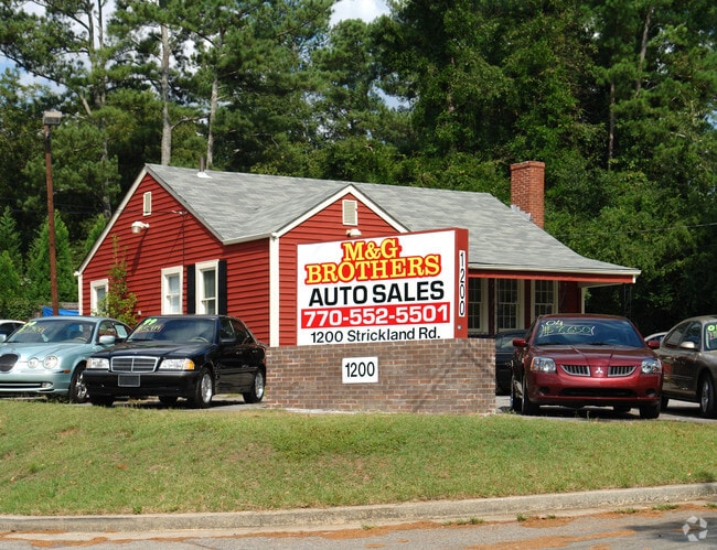
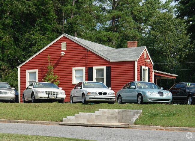
Property Record
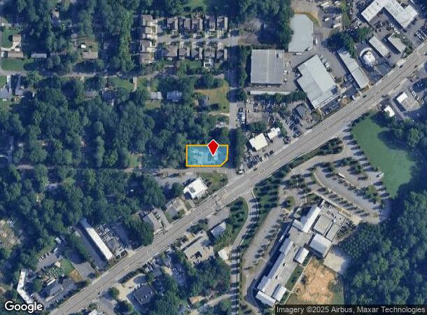
1200 Strickland Rd, Roswell, GA 30075
NEARBY LISTINGS FOR SALE OR LEASE
Property Detail
1200 Strickland Rd
Vehiclerentalsvehiclesales
Fulton
X
Georgia
13121C0061F
0.37 AC
2024
Roswell/Alpharetta
2025
Atlanta
011419
Atlanta-Sandy Springs-Roswell, GA
948 SF
12-1992-0427-071-9
DEMOGRAPHICS near 1200 Strickland Rd
1 Mile
3 Mile
5 Mile
2024 Total Population
7,968
64,987
175,921
2029 Population
8,247
66,455
178,831
Pop Growth 2024-2029
+ 3.50%
+ 2.26%
+ 1.65%
Average Age
46
40
40
2024 Total Households
3,570
26,638
69,709
HH Growth 2024-2029
+ 3.73%
+ 2.41%
+ 1.78%
Median Household Inc
$112,249
$102,083
$117,517
Avg Household Size
2.10
2.40
2.50
2024 Avg HH Vehicles
2.00
2.00
2.00
Median Home Value
$457,101
$420,765
$489,841
Median Year Built
1998
1987
1987
Nearby Places
Map Layers
Map Styles
 Street
 Aerial
- Restaurants
- Banks
- Shops
- Fitness
- Groceries
PUBLIC TRANSPORTATION
AIRPORT
Hartsfield - Jackson Atlanta International
DRIVE
WALK
Distance
Hartsfield - Jackson Atlanta International
46 min
32.2 mi
Nearby Properties
Address
Land Use
TOTAL SIZE
Lot Size
Zoning
Address
Land Use
TOTAL SIZE
Lot Size
Zoning
683,219 SF
48.04 AC
R4C
Address
Land Use
TOTAL SIZE
Lot Size
Zoning
1,078,010 SF
3.80 AC
OPC
Address
Land Use
TOTAL SIZE
Lot Size
Zoning
415,701 SF
6.75 AC
OI
Address
Land Use
TOTAL SIZE
Lot Size
Zoning
5,892,558 SF
33.38 AC
R4
Address
Land Use
TOTAL SIZE
Lot Size
Zoning
11.82 AC
Address
Land Use
TOTAL SIZE
Lot Size
Zoning
380,453 SF
10.28 AC
R4
Address
Land Use
TOTAL SIZE
Lot Size
Zoning
260,648 SF
34.20 AC
C3C
Address
Land Use
TOTAL SIZE
Lot Size
Zoning
1,672,146 SF
21.21 AC
R4
Address
Land Use
TOTAL SIZE
Lot Size
Zoning
2,674,992 SF
28.94 AC
R4C
Address
Land Use
TOTAL SIZE
Lot Size
Zoning
7,788,760 SF
46.55 AC
R4
Address
Land Use
TOTAL SIZE
Lot Size
Zoning
792,356 SF
20.07 AC
R5
Address
Land Use
TOTAL SIZE
Lot Size
Zoning
1,909,285 SF
22.39 AC
OI
Address
Land Use
TOTAL SIZE
Lot Size
Zoning
10,614,240 SF
24.05 AC
A
Address
Land Use
TOTAL SIZE
Lot Size
Zoning
2,109,527 SF
70.17 AC
OP
Address
Land Use
TOTAL SIZE
Lot Size
Zoning
8,014,916 SF
28.58 AC
R4
Address
Land Use
TOTAL SIZE
Lot Size
Zoning
10,866,920 SF
31.48 AC
AC
Address
Land Use
TOTAL SIZE
Lot Size
Zoning
510,068 SF
64.18 AC
OPMS
Address
Land Use
TOTAL SIZE
Lot Size
Zoning
938,151 SF
21.22 AC
C3
Address
Land Use
TOTAL SIZE
Lot Size
Zoning
5,499,045 SF
22.17 AC
AC
Address
Land Use
TOTAL SIZE
Lot Size
Zoning
1,791,710 SF
27 AC
ACOND
Address
Land Use
TOTAL SIZE
Lot Size
Zoning
1,185,316 SF
19.09 AC
R4
Address
Land Use
TOTAL SIZE
Lot Size
Zoning
264,255 SF
51 AC
E2
Address
Land Use
TOTAL SIZE
Lot Size
Zoning
1,071,370 SF
22.30 AC
R4
Address
Land Use
TOTAL SIZE
Lot Size
Zoning
1,069,100 SF
0.73 AC
A
Address
Land Use
TOTAL SIZE
Lot Size
Zoning
2,964,850 SF
38.74 AC
R4
Address
Land Use
TOTAL SIZE
Lot Size
Zoning
306,753 SF
19.77 AC
HMS
Address
Land Use
TOTAL SIZE
Lot Size
Zoning
878,080 SF
18.07 AC
CUP
Address
Land Use
TOTAL SIZE
Lot Size
Zoning
402,680 SF
35.81 AC
Address
Land Use
TOTAL SIZE
Lot Size
Zoning
4,758,628 SF
25.92 AC
R4
Address
Land Use
TOTAL SIZE
Lot Size
Zoning
1,861,254 SF
33 AC
R4C
The World's #1 Commercial Real Estate Marketplace
Connect with us
© 2025 CoStar Group
The information above has been obtained from sources believed reliable. While we do not doubt its accuracy we have not verified it and make no guarantee, warranty or representation about it. It is your responsibility to independently confirm its accuracy and completeness. Any projections, opinions, assumptions, or estimates used are for example only and do not represent the current or future performance of the property. The value of this transaction to you depends on tax and other factors which should be evaluated by your tax, financial, and legal advisors. You and your advisors should conduct a careful, independent investigation of the property to determine to your satisfaction the suitability of the property for your needs.